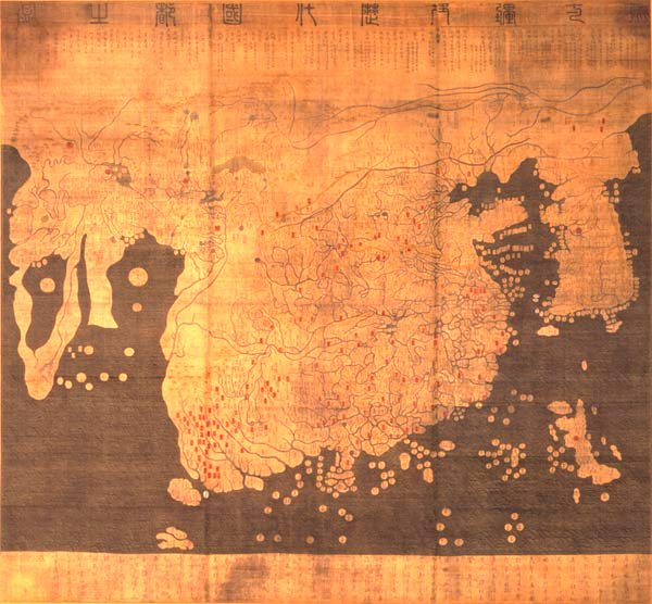
The Kangnido map of Korea from 1402, although supposedly drawn up from the notes and logs of a 1386 expedition. Painted on silk, the map depicts China, Korea, Japan, India, Africa, Southeast Asia, the Middle East and part of Europe. A product of the Mongol Empire, the map is now preserved at Ryukoku University in Japan although no one is sure when the map arrived in Japan. According to Menzies, if the map is corrected for longitude, it is quite accurate. While not an example of an advanced culture from the past with mysteriously accurate data, it does demonstrate that other nations were exploring the globe quite avidly before Europeans were yet capable of it.
Kangnido Map
|